Hi! Ferdinan Aurifio Here, a
GIS Specialist
A Gis Specialist with 4+ years of experience. Familiar with
spatial data creation for map such as landuse planning, terrain
mapping, forest monitoring, dissaster mapping, and spatial
planning zone.
Proven to assisted director general for made decision about
actions to save “Kawasan Puncak Bogor” and many more.
fire up in learning GIS software development for spatial analysis
using python and java script for Google earth engine.
Portfolio
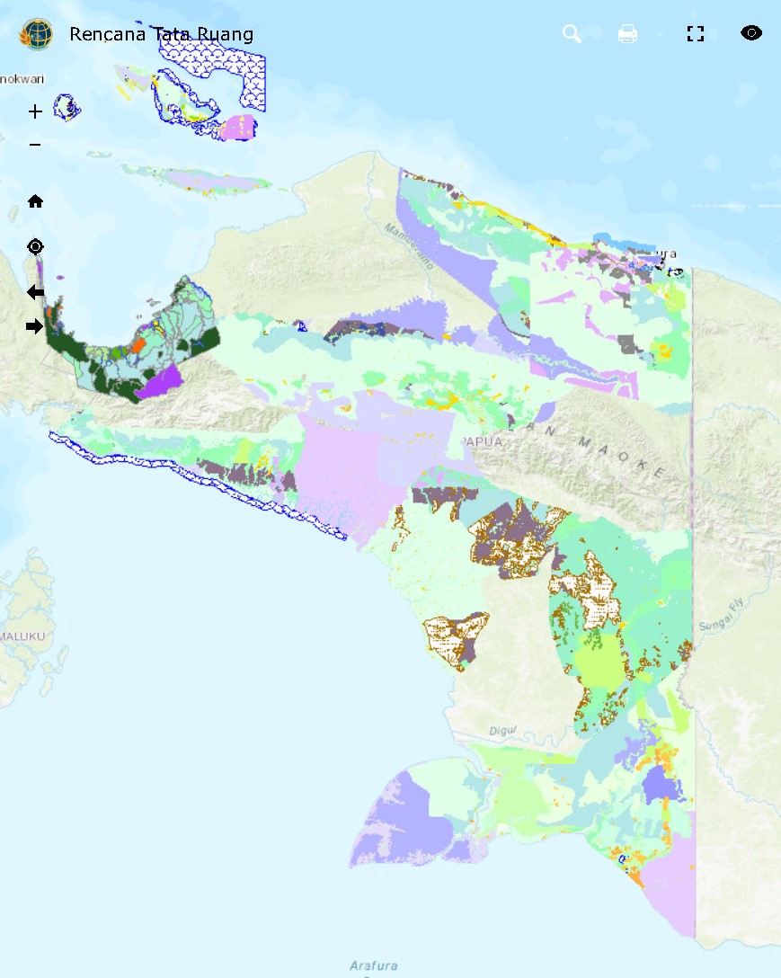
With years of experience in spatial data analysis and mapping, I have contributed to various impactful projects, including urban planning, disaster management, and environmental restoration. My work involves creating detailed maps, analyzing spatial data, and providing actionable insights for decision-makers. From mapping flood evacuation routes in Jakarta to analyzing development potential along Sumatra's toll roads, my portfolio showcases a commitment to precision, innovation, and sustainable planning.
environmental restoration
Potential Development
Space Utilization Control
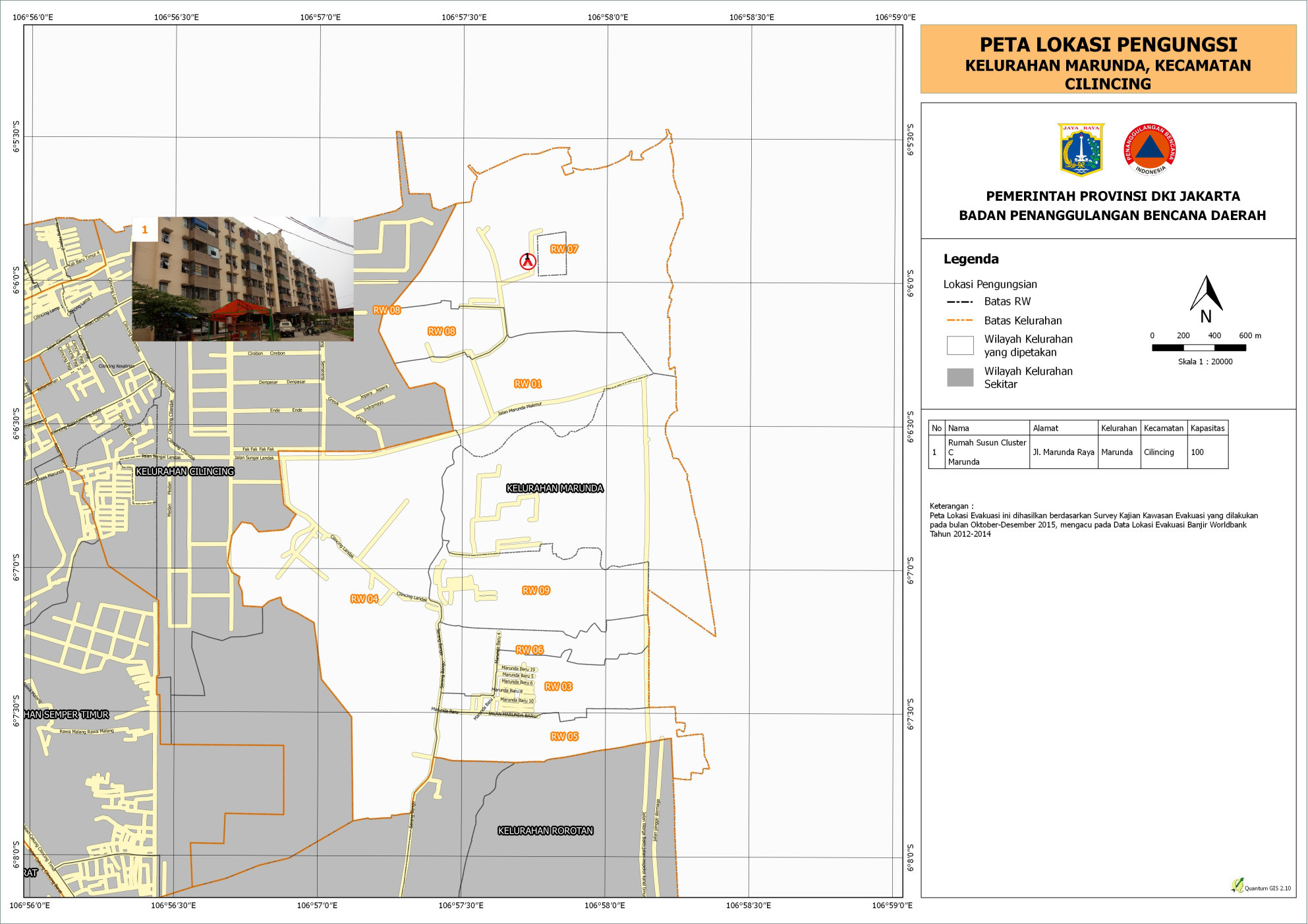
Disaster Anticipation
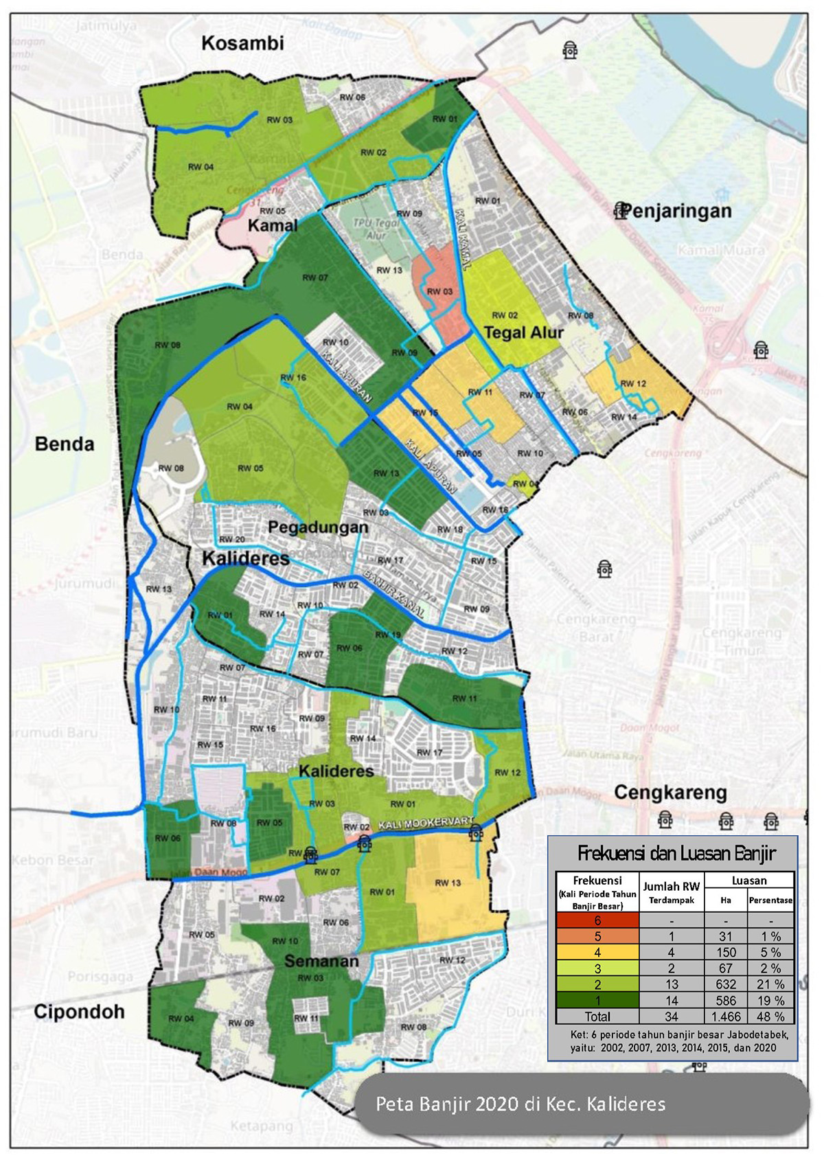
Disaster Anticipation
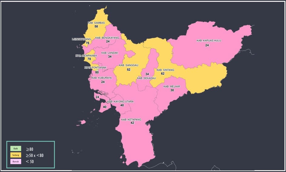
Performance Mapping
Topology Correction
About Me
.jpg)
I am a Geography graduate from Universitas Indonesia, currently working under the Ministry of Agrarian Affairs and Spatial Plan/National Land Agency. My expertise lies in spatial data analysis, mapping, and urban planning, with a focus on addressing critical issues such as environmental restoration, disaster management, and land use optimization. With a proven track record of impactful projects, I aim to contribute to sustainable development and informed spatial planning across Indonesia.
Contact
Feel free to reach out to me for inquiries, collaboration opportunities, or further information about my work. You can contact me directly below